Biking from Toronto to Niagara
Earlier in July I rode a 145km bike route from Toronto to Niagara. I made it to the end in one piece, though since it was pretty hot (25c+ with high humidity and very little cloud cover) I ended the ride feeling tired and dehydrated. That said, the ride was well worth the effort.
Here’s an itinerary for anyone planning a similar trip.
Route Overview
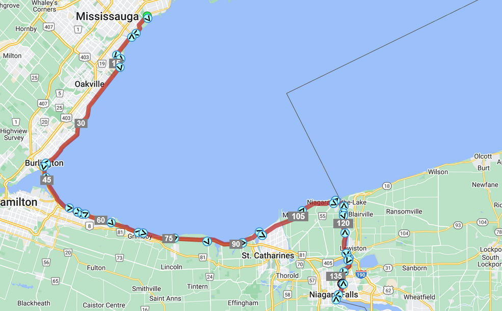
The route starts on Lakeshore Road West near Etobicoke and follows the Great Lakes Waterfront Trail west to Port Credit, Oakville, and Burlington. The route continues east along the trail to Grimsby, Dalhousie, and Niagara-on-the Lake. The route then follows the trail south to Niagara Falls.
My ride was 145km long, and lasted almost 9h including breaks (moving time was 7h).
Gear
Wearing a backpack is doable but will be uncomfortable towards the end. Save your back and shoulders by using a saddlebag, pannier, or some other bike storage.
Plan like you would for any 8-hour-long outdoor activity. An extra spare tire could come in handy, even if you have a tube patch kit.
There will be one or two 50km long sections without stores or gas stations, so make sure you can carry enough food and water to last that long (and adjust your water requirements according to the temperature).
Part 1: Toronto to Burlington (40km, 40/145 km)
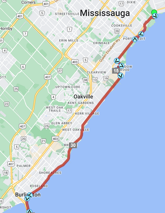
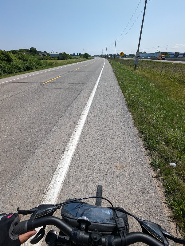
The first section of the ride is mostly urban/suburban areas. Traffic can be dense. Food and water frequent.
Follow Lakeshore West all the way until Burlington. This area is usually clear of traffic on weekends before 8am. Remember that you probably have over 5 hours of riding left once you reach Burlington, so ride at a slow pace.
Part 2: Burlington to Grimsby (30km, 70/145 km)
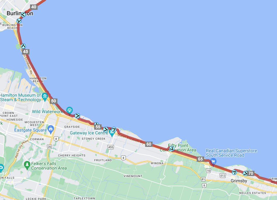
Suburban residential areas through to Grimsby, with increasingly long and frequent patches of farmland between QEW ramps. Stops for food and water 5-10km apart.
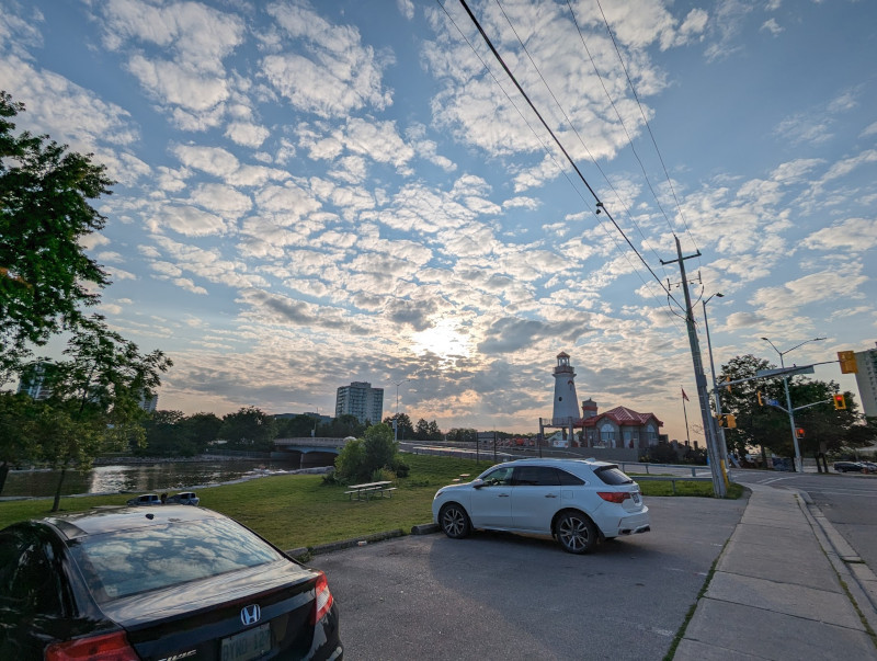
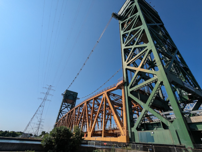
Turn left at the Brant Street Pier and follow the mixed-use path south. Ride along the Waterfront Trail and follow the signs for the Canal Lift Bridge. The trail goes past the bridge then turns under it and rises to meet the road. After crossing the canal, get off the bridge and head north to the Breezeway Trail, and follow it east. The trail is a mixed-use path that travels through parks along the shore, so keep an eye out for pedestrians. The trail ends in a residential area north of the QEW.
Follow the Waterfront Trail/bike route signs. These signs will take you east on the North Service Road along the QEW, occasionally turning off the road into residential areas to avoid highway onramps/offramps. North Service Road has a speed limit limit of 80kph and shoulders are nonexistent in some areas.
Part 3: Grimsby to Dalhousie (25km, 95/145km)
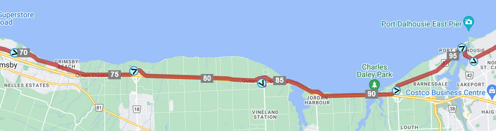
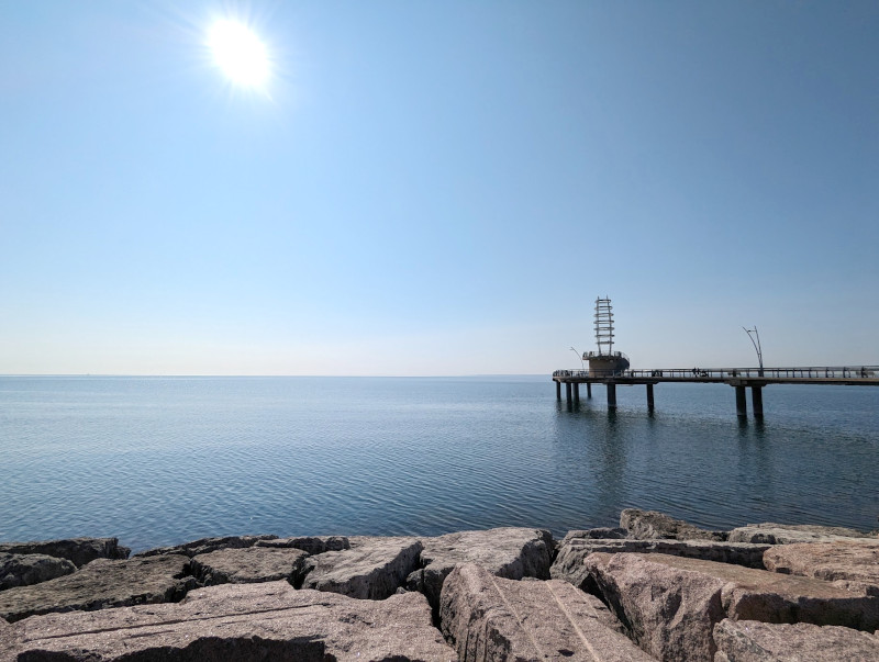
A very long rural stretch. Mostly farmland and vineyards. Stops for food and water 10-15km apart, with stops in urban Dalhousie.
Continue following the N Service Road until the 90 km mark, then turn left onto Lakeshore Rd W and follow it straight to downtown Port Dalhousie.
This is where staying hydrated and fed becomes especially important. If you were not eating something and drinking a bottle of water every hour, it’s likely that you will start to hit the wall at this point. Make sure you’re also having electrolytes otherwise you will probably start to suffer during this section.
It will be hard to find food and water here, as most of the route is farmland. There is very little shade and you will spend most of your time surrounded by concrete, so staying cool is important.
Port Dalhousie is a good spot to refuel and grab extra food/water for the next section.
Part 4: Dalhousie to Niagara-on-the Lake (NOTL) (20km, 115/145km)
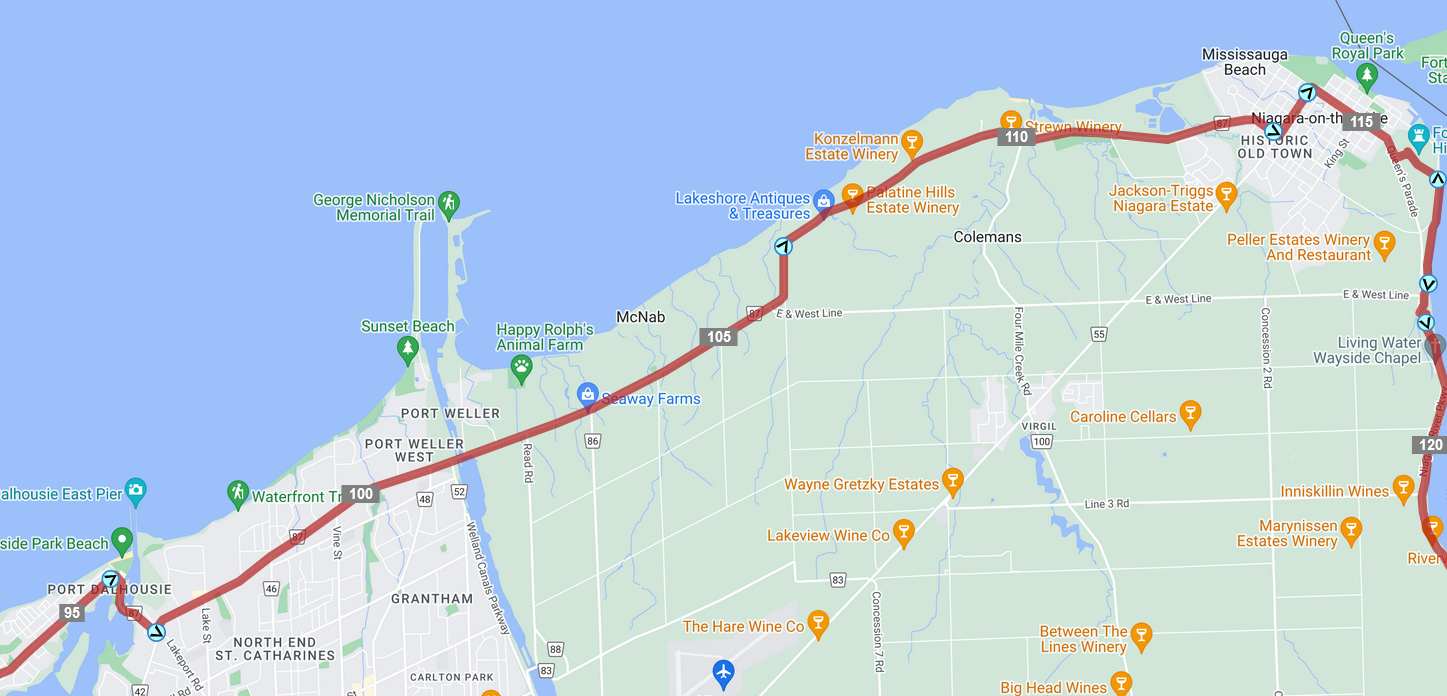
Suburban/industrial until the Welland Canal, then farmland again until downtown Niagara-on-the-Lake (NOTL). No food and water between Dalhouse and NOTL.
Turn south out of Dalhousie on Lakeport until you get to Lakeshore Rd then follow it west along the shoreline, ending in NOTL.
Food and water are also important here. There is very little shade until the end. NOTL is a good spot to refuel.
Note that the directions for the past 55km are almost identical. These parts of the route are monotonous and flat. I started to overheat and think about stopping at this point. Reminding yourself why you’re doing this ride (and having a good reason) might help you continue.
As you approach NOTL, the route turns onto smaller rural roads. Most drivers gave me room when passing, though there is often no shoulder (unlike the service road). Road conditions ranged from great (brand new asphalt) to poor (2km of gravel-like milled road).
Part 5: Niagara-on-the-Lake to Niagara Falls (30km, 145/145km)
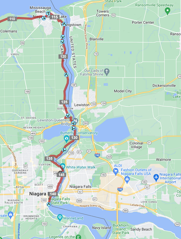
Rural immediately after exiting NOTL. No food and water for 20km between NOTL and Niagara Falls.
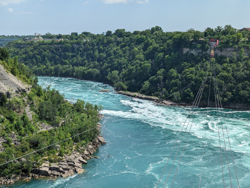
Exit NOTL and turn onto Niagara Parkway Trail. Follow the trail south until you get to the falls. The route passes by Niagara GO at km 137, continues south for 4km until the falls, then turns back around and ends at the GO station.
After 115km of flat land, the final stretch to the falls is mostly uphill. The first 10km are a gentle uphill slope, followed by a 5% climb for 1km near Brock’s Monument. The trail will be busy, with lots of cyclists and pedestrians. I had to bail out early and go directly to the GO station to catch the train back.
Grab some food, rehydrate, and enjoy the 2h drive/train ride back to Toronto. If it’s especially hot out you may have mild heat exhaustion, and feel tired tomorrow. Spend the next day celebrating the fact that you travelled all the way to Niagara on your own two legs.